Sunday, December 30, 2012

COLD WEATHER WILL RING IN 2013...

PREDICTABILITY OF FORECAST PERIOD: HIGH through FRIDAY, MEDIUM Saturday/Sunday

1. Monday and Tuesday are the warmest days of the week, with temps in the upper 30s. Lows in the 20s. A few flurries possible Tuesday morning. Mainly cloudy, especially towards evening Monday. Winds relax somewhat, but it will still remain a bit breezy this period.

ACCUWEATHER "BALL DROP" WEATHER


2. Tuesday night-Saturday: Significant cold shot (coldest air of the winter thus far) will assert itself. Much, if not all of the period should feature temps never making it to 32 degrees.

NOAA

NOAA


3. Wednesday night and thursday night: temps should plummet to single digits in the outlying areas for overnight lows, especially where snow covers the ground. Daytime HIGH temps Thursday and Friday will hover around 29-30 degrees, with wind-chill values in the teens.

4. Mainly precip free period, but have to watch for a storm threat over this coming weekend.

5. Mid-month warm up looking likely, as wintry pattern relaxes. However, a  rejuvenation of winter should start anew by 1/20.

6. Below are the Saturday 12/29 snowfall amounts: Compared to the forecasts, most places were close or even went over, but north of NYC. Coastal sections underperformed, while eastern CT got slammed!


Saturday, December 29, 2012

12/29/12 final snowfall map


for a fairly minor storm, this appeared to be a tough forecast. The track of the storm changed from an offshore one to that which was a bit closer to the coast. Adjustment to the west allowed for heavier precip to fall (which it will with liquid amounts near .50), but it also will allow milder air to penetrate the coastal plain. Much of the Island is out of the question for the three inch amounts, but they might receive a coating on the back end of the storm, once colder air is able to filter back in from the west. So overall, not a bad call, but could have been better.

The end of the week cold air mass is not to be trifled with.  It looks like bitter arctic air will make its first real push into the region, with perhaps some snowflakes around the time of the ball drop. The intellicast graphic for temps this week will take a beating; below is the old graph versus the new one, and there's no question that this is looking a  lot colder for Tuesday and beyond.

OLD INTELLICAST FROM THURSDAY


NEW INTELLICAST:


OUCH! We don't get out of the 20s for high temps for Thursday and Friday. Night time lows (especially in the snow covered areas) will hit single-digit territory for one of these night as well.


Thursday, December 27, 2012

LIGHT SNOWFALL LIKELY FOR SATURDAY INTO SATURDAY NIGHT

PREDICTABILITY OF FORECAST PERIOD: MEDIUM

The first accumulating snowfall is looking likely for NYC for the true winter season.

 Recall that we actually saw a decent accumulation ( and record snows for the date) but back on November 7th.

Areas nearest to the coast will get the most snow, as the storm system responsible for it will be far enough offshore to spare the region of a major winter storm.

KG- using accuweather/NOAA blend


Cold, blustery weather will take hold, with yet another storm around Tuesday or Wednesday of next week to watch out for.

Intellicast


Temps may plummet to their lowest levels of the winter by next Thursday and Friday.

Monday, December 24, 2012

TWO MAJOR COASTAL STORMS THIS WEEK

PREDICTABILITY OF FORECAST PERIOD THROUGH TUES EVE: HIGH

PREDICTABILITY OF FORECAST PERIOD WED THROUGH SUN-MEDIUM

Lets take them one at a time. Get use to this the next couple of weeks

CHRISTMAS EVE: Light precip (mostly rain at the coast) with a dusting-2" inland from 4pm-midnight. Dry, but chilly Christmas day, cold at night.

ACCUWEATHER OLD MAP


ACCUWEATHER NEWER MAP (VERY SIMILAR)


NOAA


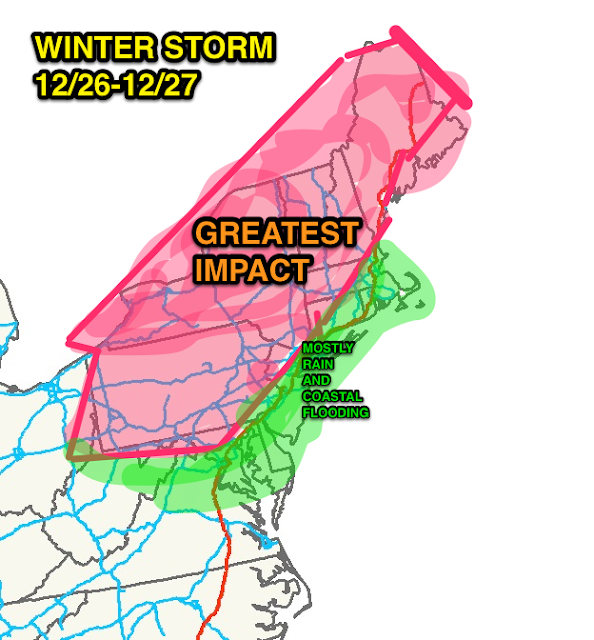
WEDNESDAY AFTERNOON INTO THURSDAY AFTERNOON: Heavy rain/strong winds near the coast, with mixed precip/ice inland. High potential for coastal flooding. Heaviest snows well inland, with upwards of a foot in the pure snow-zone, up to half that amount in the "mix" zones. Coast stays wet, while inland and points north are white. Windy conditions will persist into early Friday morning.

KG's Opinion


ACCUWEATHER


Intellicast temps:


SATURDAY INTO EARLY SUNDAY: Potential increasing for another winter storm. Strong shot of cold air arrive for New Years' Eve/Day, with arctic air mass enveloping the region.

CPC.NOAA.GOV

CPC.NOAA.GOV

Friday, December 21, 2012

POTENTIAL INCREASING FOR TWO ACCUMULATIING SNOWFALLS NEXT WEEK


The highly touted stormy weather pattern is evolving from warm and rainy to that of snowy and cold, and the next 10-15 days should produce two to perhaps three wintry weather events for the tri state area. Two of those three storms could carry substantial precipitation, with a minor even on Christmas eve/day.


ACCU-weather Mon/Tues Storm


ACCU-weather Wednesday night/Thursday storm

Any further south track of these storms could easily shift the heavy snows into NYC and Long Island. We've seen it happen several times in the past few years, where projected tracks favoring a mixed precip event ended up colder. 


The third system (not depicted in graphical form yet) would follow around New Years’ Eve/Day.
The rest of the overview is on track from the last two posts
More to come Sunday or early Monday

Wednesday, December 19, 2012

A PERIOD OF VERY STRONG WINDS AND HEAVY RAIN LIKELY FOR EARLY FRIDAY MORNING


PREDICTABILITY OF FORECAST PERIOD: MEDIUM
 
The latest in a series of storms will barrel towards the region on Friday; it will serve to usher in sustained cold through the holiday season, and as it does so, it will bring very strong winds and soaking rains to the region Friday morning.
 
A rough Friday morning rush hour may be in store, particularly from 6am onward.
 
NOAA Graphic says it all:

NOAA NWS New York on Twitter/Facebook

 
Expect airport and transit delays as well as some isolated power outages.
 
Although the winds will abate somewhat Friday, generally blustery weather will continue through the weekend, with scattered rain and snow showers during the afternoon hours for Saturday and Sunday.

Accuweather.com

 
Actual temps will finally remain near their normal December levels through Christmas, which is a far cry from a virtual sea of warmth which has, up until now, engulfed the lower 48 states for the majority of the month (opposite of November).

HPC.noaa.gov

 
Lows at night from Saturday through Tuesday will be in the 20s area-wide.
 
A weak storm may be able to produce some very light snowfall on Christmas (late Monday evening into early Tuesday morning). Thereafter, another storm – which looks to be much stronger – could impact the region around Thursday into Friday with both rain and snow.
 
The pattern is such that another storm will be possible around New Years’ Eve/Day, as the big blocking High pressure remains entrenched over Northeast Canada, and storms run underneath it to the eastern seaboard.


More to come over the weekend…

Saturday, December 15, 2012

STORMY PATTERN TO GROW BOLDER AND COLDER THROUGH THE END OF 2012


PREDICTABILITY OF FORECAST PERIOD: MEDIUM
 
1. Main theme of Sunday/Monday storm still on track, but with even less emphasis on inland snow/frozen precip. Could start out frozen north and west of town, but it’s mainly periods of rain Sunday into early Monday. Temps start in the 30s, but rise into the 40s Sun-Mon.

NOAA HAS FREEZING RAIN ADVISORIES THROUGH NOON SUNDAY IN AREAS IN PURPLE


2. A quick break, then another rainmaker arrives Monday night into Tuesday early afternoon. Temps in the 40s. Windy. Heavy rain likely Monday night/Tuesday morning, with potential of an inch of precip. 
 
3. Quiet Wednesday through Thursday, but then another storm in the pipeline develops and heads into the region. Snow/rain mix Thursday afternoon, giving way to rain Thursday night/early Friday. Coldest air of the winter season filters in behind Friday storm, with temps in the 30s. Very cold looking weekend ahead.

ACCUWEATHER SLIDE:


4. Threat of yet another storm around Christmas.  Potential for more snow/frozen precip everywhere, as more cold air can be tapped from up north. Bears close watch.

intellicast Temps:


5. Expect more of the same through the New Year: Increasingly colder, with frequent opportunities for storms with wintry precip. Above average precip likely. Above average snowfall likely through at least the first week of January and quite possibly a bit beyond. Pattern resembles a very active one, with storms and prospects for storms.


Monday, December 10, 2012

LATE WEEKEND STORM WILL BE WINTER’S OPENING SALVO!


PREDICTABILITY OF FORECAST PERIOD NOW THROUGH SATURDAY-HIGH

PREDICTABILITY OF FORECAST PERIOD FOR SUNDAY-MONDAY: LOW
 
1. Overview on track through Thursday. Temps cool mid week, but rebound to near 50 Friday. Dry conditions through Saturday.

INTELLICAST TEMPS:


2. Weak front crosses Friday, but does bring a shot of cooler air for Saturday. Temps in the mid 40s Saturday, with increasing clouds late in the day
 
3. Potential winter storm Sunday into Monday. Heavy precip possible from intensifying coastal low. Wide spread in model guidance; very low confidence, but odds favor interior getting snow/mix, with rain at the coast if the storm comes close (NYC metro included in the rain category, for now).
 
4. Major period of stormy, cold weather for the holiday season looking likely nationwide. Strong blocking high pressure over Northeast Canada that was absent last year should combine with active storm track to produce above-average wintry precip through early January. Test will be to see if NYC gets over 6 inches of snow between 12/15-1/05/13 (if not, it’s a major bust considering how long this idea has been out there).


Wednesday, December 5, 2012

UNSETTLED, BUT MILD PATTERN THIS WEEKEND AND EARLY NEXT WEEK

PREDICTABILITY OF FORECAST PERIOD: MEDIUM


HIGHLIGHTS:

1 Previous overview on track through Thursday.

2. Friday starts to get unsettled and damp, but the milder air works in as well. Risk of a few light showers north of NYC Friday, then spreading east by Friday night.

3. Periods of rainfall for the weekend, especially late Saturday, Sunday night, then again Monday afternoon/night with a strong cold front. Very mild. Could even see a stray thunderstorm Monday with highs in the upper 50s and a strong front nearby. Cooler day Sunday, with temps in the upper 40s.


4. Tuesday through Thursday: Much colder, but things clear out. Temps essentially around normal December levels.

INTELLICAST TEMPS SHOW THE COOL-DOWN


DISCUSSION: After a brief punch of cold from Wednesday night (tonight) through Thursday night, temps will start to climb once again. However, the renewed surge of mild air will come with a price; periods of rainfall will ensue from late Friday through much of Monday night, before another burst of cold weather lunges in for Tuesday through Thursday of next week. The situation is reminiscent of the opening of last December, and for that matter, much of winter 2011-2012  (short, sharp shots of cold in a sea of warmth).


But don't let it fool you into a false sense of security (yet).

Going into December, the consensus for this month was that cold air would decidedly win out by the tenth; now, indications are that seasonal temps will begin to only gradually infiltrate by Tuesday or Wednesday of next week (around the 12th).


 Moreover, while an uptick in rainfall seems likely, the overall pattern is not conducive to significant wintry precip through the 13th. But the overall message put forth here (obviously with help from the pros), even though delayed by about five to six days, still holds sway; increasingly cold, stormy weather should take hold and the threat of a harsh period of winter weather right around the heart of the holiday season is something to keep in mind as we go forward.


Monday, December 3, 2012

NEXT WEEK'S STORM COULD GET THE (SNOW) BALL ROLLING ON WINTER

The record books will be filled up today, as spring-like warmed encased much of the lower 48 states. Chicago and DC had temps in the low 70s, and here in nyc, we managed to touch 60. Another day of near-record warmth is on the way tomorrow, before the expected turnaround comes in Wednesday morning. 

The Weather Channel
Temps will start falling off rapidly by Wednesday afternoon; I'd be tempted to just bring the heavy jacket for work Wednesday, as our high for the day may very well be realized before noon. 

Next week's storm will come through the area Sunday or Monday. While it will most certainly bring rain to the area, the storm itself may be the trigger that can start a more persistent cold/stormy regime around the country. We were looking for the change to take place around the 6th, but this may be delayed for a few days longer, more like the 10th. 

More tomorrow. 

Thursday, November 29, 2012

DECEMBER OPENS UP AS WARM AS ADVERTISED


PREDICTABILITY OF FORECAST PERIOD: MEDIUM
 
1. Spotty light rain Friday night towards the coast/NYC, with some light freezing rain/snow in Orange/Rockland/Putnam counties and adjacent counties in NJ/CT. Watch for icy roads late Friday night in these areas. Temps in the 30s everywhere Friday night.
 
2. Periods of light rain/drizzle will persist into Saturday and Saturday night before a break ensues Sunday during the day. Warm air makes inroads in the northern counties early Saturday, so that frozen/ice threat is shut off early. Temps rise throughout the weekend (persistent cloud cover notwithstanding). Readings will climb even at night; temps will gradually move into the 50s Sunday.

NOAA RAIN CHANCES SATURDAY THROUGH MONDAY:


3. A period of some heavier showers Sunday night. Break for Monday and much of Tuesday, with very mild temps close to 60! Plenty of clouds though; some partial breaks of sun

INTELLICAST TEMPS:


ACCUWEATHER OVERALL PATTERN SHOWS WARMTH DOMINATING THE LOWER 48 STATES


4. Sharp turn to colder temps (average temps) Tuesday night/early Wednesday morning, as front comes through with showers. Blustery Wednesday afternoon into Thursday, with highs in the 40s.
 
5. Signs in the long term still lean towards a turn to a more persistent cold, stormy pattern by mid-month. Previous posts, video and links handle this.
 

Sunday, November 25, 2012

MORE ON MID WEEK STORM AND A VIDEO ON DECEMBER PROSPECTS

PREDICTABILITY OF FORECAST PERIOD: MEDIUM

MID WEEK STORM: The old map is similar for NYC and points eastward, but the snow amounts were adjusted to lesser values north and west of NYC. The timing looks like Tuesday morning, with another shot of light to moderate precip Tuesday afternoon and night. Overall, less than a half of an inch of liquid will accompany this storm, thus making the impact low to commuting and everyday plans.

Old MAP


UPDATED NEW MAP


NOAA and Accuweather have basically the same idea accumulation-wise.

Accuweather - LEFT......NOAA-RIGHT


The next chance of precip (rain) will be sometime Saturday night into Sunday.

LATE THIS WEEK/NEXT WEEK: The theme of a back-and-forth, roller coaster winter will be showing itself in full force the next two weeks. After a very chilly start to the work week and the mid week storm, a big warming trend will commence as we open December. A stretch of very mild weather  
should encompass much of the lower-48 states through at least 12/5.

NOAA's Long Range temp outlook is quite bullish on the warm idea for Saturday through Wednesday of next week:


INTELLICAST TEMPS FOR NYC NEXT SEVEN DAYS show the trend nicely:


Thereafter, the overall pattern will reconfigure itself yet again; this transition should allow for a substantial period of wintry weather, which could last 10-15 days, leading us right into the heart of the holiday season.


VIDEO: December Looking Cold, Stormy:

The video shows what it takes in the overall pattern to make it cold and snowy in the northeast states. A comparison of last December versus the (likely) pattern going into this December (especially after the 5th):


Saturday, November 24, 2012

WINTER STORM LOOKING LIKELY FOR THE NORTHWEST BURBS TUESDAY THROUGH WEDNESDAY AFTERNOON

The last time NYC saw two accumulating snows in November occurred in 1938. The November monthly snowfall record is 19.0", which was established in 1898.  

AREA IN GREEN ON MAP IS MIXED PRECIP/MOSTLY RAIN. 
SOURCES ARE WEATHERBELL, ACCUWEATHER, AND WEATHER.GOV/OKX


The track of the storm, plus the warm temps aloft which are forecasted by most of the models, seems to suggest that NYC and the coast are going to see a rain/snow mix, with perhaps a light accumulation. However, as we learned from the November 6th storm, a shift south could put the city in play for more snow. 

Tomorrow, we'll discuss what makes a cold, snowy pattern around these parts (in a large scale sense) and there will be an update on the mid week storm

more later. 

Monday, November 19, 2012

TWO SHOTS OF WINTRY CHILL NEXT TEN DAYS


PREDICTABILITY OF FORECAST PERIOD: medium

1. Previous post makes the case that winter is already underway in our area. 
 
2. Rainfall chances were a bit overdone here, as storm remained even further off shore this week. Risk of some coastal flooding, albeit minor, remains on the Jersey coast this week through Thursday. Vulnerable beaches left in Sandy’s wake make even minor events more magnified (this will be a theme through winter).

ACCUWEATHER FLIGHT DELAY MAP:


3. Mainly quiet through Friday, but a robust cold shot  arrives early Saturday through Saturday night. Coldest weather of the fall season arrives Saturday night, with some light frozen precip possible inland during the day Saturday (probably morning). Very windy and cold Saturday night, with wind-chills in the teens and actual lows in the 20s to near 30.
 
4. Highs struggle to climb into the 40s Sunday, even in the warmer spots! A blustery day for Sunday. 

NOAA DEPICTION OF TEMPS SAT-SUN LOOK OVERDONE


INTELLICAST TEMPS SAT-SUN


5. Monday-Tuesday, temps rebound closer to 50. Fair and tranquil, but then another shot of windy cold weather for the last weekend of November looking likely; storm will be accompanied by rain around the 29th/30th. 
 

6. Video this coming Sunday or Monday will look at last December (2011) versus depiction of long range models for this December (2012). Evidence mounting that a fast start to winter will continue, with uptick in storminess likely for much of the holiday season.

Sunday, November 18, 2012

WINTER HAS ALREADY BEGUN...

Since November 1st, we have had three recorded days in Central Park where the average daily temperature has reached positive territory. The cold has won in a rout; the monthly average temp in the Park will, in all likelihood, end up being the coldest month we've seen in these parts since December 2010 (against the monthly averages).

The long term picture is shaping up to be the exact opposite of last December. Prospects for a fast start to winter have not only shown themselves already, but overall, are lining up so that December looks cold and stormy for the east.

Last year, i was only at the point where i did emails. The blog was not created yet. but for the loyal viewers out there, i noted that December 2011 would, in fact, be tame. Now, it appears that we're headed to a big time reversal.

more later.

Thursday, November 15, 2012

Saturday, November 10, 2012

MORE ON THIS WEEK'S WEATHER

what else did you expect it to be about ???

First, the attempt at a video today was unsuccessful. There is a software issue which is being worked on, and videos should resume sometime this week.

The snowfall from the Wednesday storm was impressive, with records being shattered all over the area.


And the snow cover from Sandy and this past week's storm still remains!


Moving ahead, the warmth for Sunday and Monday is on, with a mild Veterans' Day on tap.


With such warm temps over the cooler ocean waters, some dense fog is possible Sunday night away from the city. In spite of the overall warmth of Monday, low clouds and fog may have a tough time burning off. 


The temps from Intellicast vs the newer version are fairly similar, but they have trended lower for Tuesday.

Old forecast from Nov 7

New one from Today:


That's because the timing of the rainfall is being adjusted to faster; expect periods of light to moderate rain from late monday night into Tuesday morning, before clearing takes place Tuesday night and beyond (at least through Friday). The rainfall should average .25-.50 through the period. 

Behind the front Tuesday afternoon, winds should pick up, making Tuesday evening a pretty chilly one. 

Lurking for the Thanksgiving week is a reconfiguration of the pattern. The signals are starting to hint at an important storm around the 22nd.