Tuesday, June 11, 2013

STRONG LATE SPRING/EARLY SUMMER STORM WILL INDUCE MORE FLOODING ACROSS THE TRI STATE AREA FOR THURSDAY INTO THURSDAY NIGHT


After a windy, but dry day on Wednesday, a potent coastal storm will develop and track towards the area on Thursday with more heavy rain and isolated thunderstorms. The region will be on the northern side of the storm, which will limit severe weather chances aside from the flooding.

Accuweather
In the zone in red, a significant wind damage/tornado threat exists for Thursday. If the forecasted path of the low pressure holds firm, the immediate tri state area will only experience heavy rain and isolated severe thunderstorms. However, an additional update may be needed if the severe weather threat area gets bumped north tomorrow afternoon. 
 
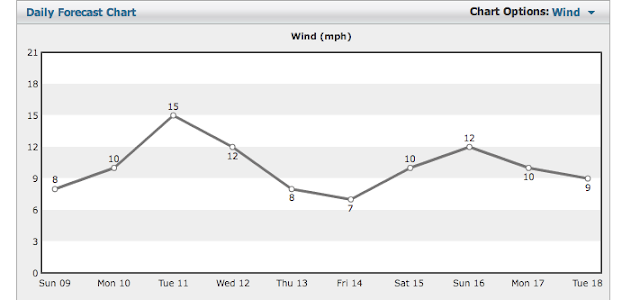
Strong winds will mount on the coast, with frequent gusts to 40mph possible in the afternoon and evening. 

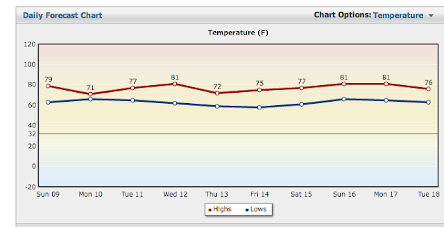
Temps will be miserable for this time of year as well, with readings struggling to get to the mid-60s.
 
The storm will tend to linger a bit into Friday with residual scattered showers and times of cloudiness
 
the weekend still looks warm and dry.
Sunday, June 9, 2013

A NEW WEEK, WITH MORE UNSETTLED WEATHER LOOMING

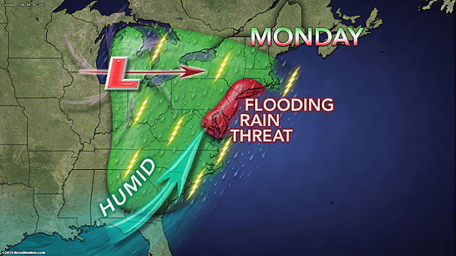
1. Heavy rain threat will begin anew Monday into Tuesday, as a slow moving warm front pushes through the region. A general 1-2 inches of rain area-wide is likely, with some higher amounts possible in isolated locations.  Best opportunity for heavy rain will be Monday afternoon into Monday evening, with only light to moderate rain falling during early Monday morning through early afternoon.


Accuweather
2. Rain tapers off overnight Monday into Tuesday, but the threat of showers will increase for Tuesday into Tuesday night with the passage of a cold front.

3. A break comes for Wednesday, with dry conditions. Another significant rainfall is possible on Thursday, with the potential for another 1-2 inches of rainfall. This will need updating.

Intellicast WInds


4. Friday through the weekend looks decent for now, but no summer-like warmth is on the horizon just yet, as the overall pattern will keep the searing heat to our south and west over the southern plains states.


Intellicast Temps

CPC 6-10 day temps

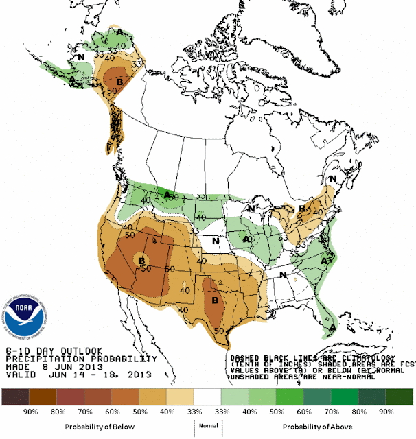
CPC 6-10 day precipitation