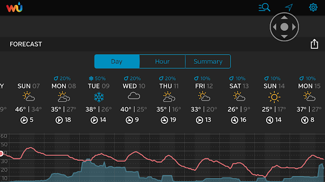
1. Thursday is quite windy all day, with winds peaking towards evening. A few snow showers could move through in the mid-to-late morning with no significant accumulations. Winds relax late Thursday evening. Temps around 30 for highs.
2. Friday: Dry, with more passing snow showers late at night. Arctic cold front moves through overnight Friday/early Saturday, setting the stage for the coldest air mass of the season.
 |
| FIOS1 Weather |
3. Saturday: Dry, but turning dangerously cold through the day and into the night Saturday night. Temps will hit their high for the day around sunrise Saturday morning (20s), then steadily fall throughout the day. Readings by noontime Saturday will be in the teens everywhere, with wind-chill values near 0.
4. Severe cold envelops the area Saturday night, with record low temps possible. NYC has another shot at hitting the elusive 0 degree mark for the first time since 1994. If caught unprepared on Saturday night, the combination of wind-chill values of -20 or lower and actual temps near or below 0 could prove life-threatening.
5. Dry and cold for Sunday and Presidents' Day. Storm develops over the plains states and tracks towards the area around Tuesday. Departing frigid air mass means that rain and/or snow is a possibility during this time frame. Update will be needed over the weekend.
 |
| Weather Underground |
6. Warmth develops late next week. Brief 5-7 day warm interlude before winter re-loads for the week of the 22nd and beyond.

