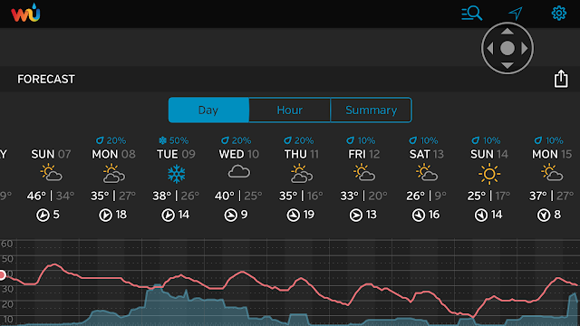
In short, the weather for Monday and Tuesday will be characterized by intermittent light snow and cloudy skies. Two storm systems will brush the area with light snow in a span of two days, with the heavier amounts east of NYC. The total snowfall idea shown here combines both storms. Areas over eastern Long Island towards the Twin Forks stand the best chance of seeing "surprise" amounts, but again, this snowfall will encompass a two day period.
The long duration of the storms, combined with the generally light amounts will make for a relatively low impact to commuters through mid-week.
 |
| Weather Underground |
Conditions dry out for Wednesday. The next big weather story around here will be a brutal arctic air mass, which will arrive for Valentines' Day weekend. Temps for Saturday night/Sunday morning could be a few degrees colder than what is shown above; readings may be near 0 north and west of NYC for early Sunday morning.
No comments:
Post a Comment