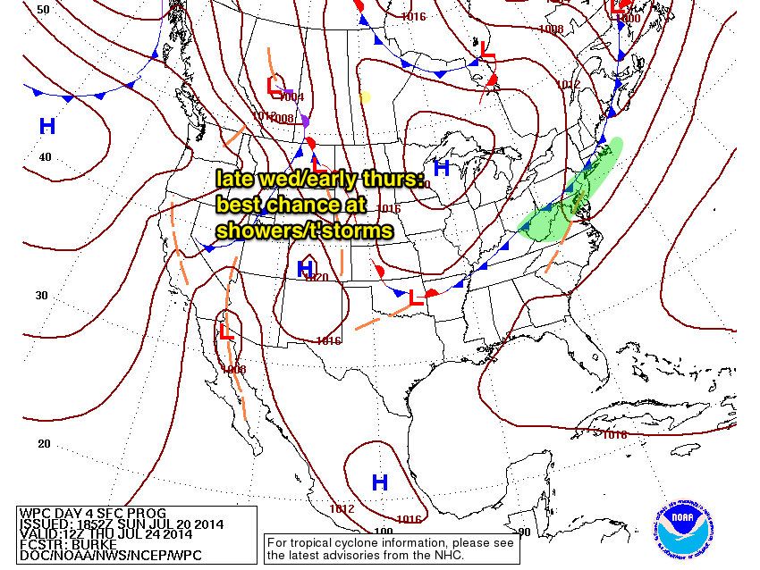
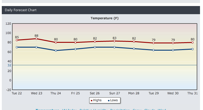
1. Previous video on track. Best opportunity for seeing first 90˚ reading at Central Park since July 8th comes tomorrow, with hot humid air mass lasting one more day before a return to near normal temps. Showers and
storms wait until after 6pm to cross into NYC and points east, but north and west, things may start firing up by mid-to late afternoon.'
 |
| NOAA |
 |
| Accuweather.com |
2. Threat of leftover showers exists Thursday, but mainly east of the city. Skies clear out and conditions remain dry through Saturday afternoon.
 |
| Intellicast.com |
3.
Unsettled pattern gradually works in by late Saturday night with a few storms around. However, nothing really widespread threatens us until late Sunday into Monday morning, then again Monday afternoon and night (in the form of showers and t'storms).
4. Big plunge in the jet stream will keep temps at bay through next week, with
no real oppressive heat in the cards.


