The warmth of this week took us back to typical temps that we'd see in late August/early September. However, after a pleasant Friday and a warm, windy day Saturday, our temps will become much cooler beginning late Saturday afternoon and night, and
this will continue for the balance of the upcoming week.
 |
| Intellicast.com shows the location of the cold front 8am Saturday morning... |
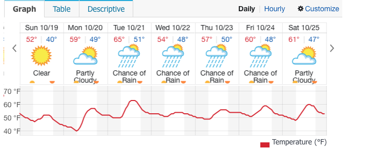
In fact, highs on Sunday will struggle to reach the mid-50s; that's easily 10 degrees below where daytime readings should be for this time of year. It'll be
breezy both weekend days, but winds will feel much chillier on Sunday since by then, they will prevail from a northerly direction.
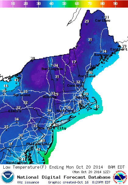
Our first opportunity for widespread sub-40 degree low temps comes Sunday night, especially outside of NYC.
 |
| NOAA-Low temp forecast Sunday night/Monday morning |
 |
| Intellicast.com |
 |
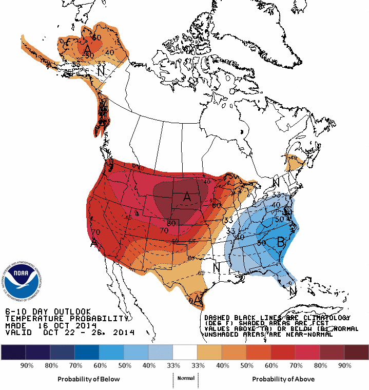
| Climate Prediction Center: 6-10 day temp probability shows "below normal" in the eastern U.S. |
The
rain we had this week looks to be a pre-cursor for more rain next week. Another slow-moving storm will develop to our south by Tuesday and meander northward during mid-week. This could lead to a period of steady rain and increasing winds Wednesday; while the
exact amount of rain for mid-week next week is uncertain,
easterly winds will help to lock in the clouds, as well as low level moisture and cool temps beginning Tuesday and continuing through much of Thursday, as the stubborn storm slowly moves away.

