1. Heavy rain threat will begin anew Monday into Tuesday, as a slow moving warm front pushes through the region. A general 1-2 inches of rain area-wide is likely, with some higher amounts possible in isolated locations. Best opportunity for heavy rain will be
Monday afternoon into Monday evening, with only light to moderate rain falling during early Monday morning through early afternoon.
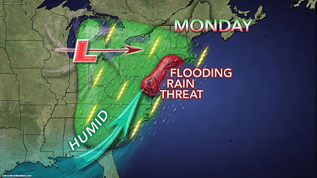 |
| Accuweather |
2. Rain tapers off overnight Monday into Tuesday, but the threat of showers will increase for Tuesday into Tuesday night with the passage of a cold front.
3. A break comes for Wednesday, with dry conditions. Another
significant rainfall is possible on Thursday, with the potential for another 1-2 inches of rainfall. This will need updating.
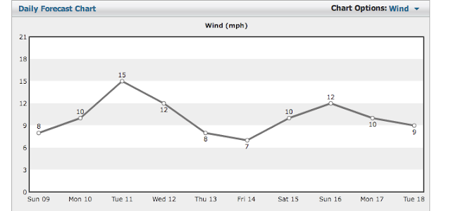 |
| Intellicast WInds |
4. Friday through the weekend looks decent for now, but no summer-like warmth is on the horizon just yet, as the overall pattern will keep the searing heat to our south and west over the southern plains states.
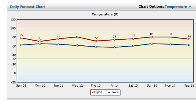 |
| Intellicast Temps |
 |
| CPC 6-10 day temps |
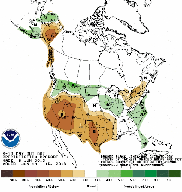 |
| CPC 6-10 day precipitation |


I might prefer a wee bit less rain but I do prefer the searing heat stay to our south and west. Merci
ReplyDelete