 |
| WPC: Rain chances for 7am Saturday |
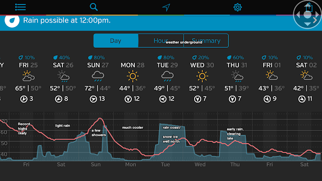
2. Additional scattered showers will move through the region on Sunday, but the overall extent and coverage of these showers will be less than Saturday's rainfall.
3. Monday is dry, but much cooler. Temps may get stuck in the 30s for the Mid-Hudson Valley and points north. Closer to the coast, highs will be in the 40s.
4. Rain for Tuesday, ending by evening. Snow and ice for areas well inland, then changing over to rain. Potential for ice accumulations Tuesday morning well inland.
5. Dry for Wednesday, then light rain early on New Years' Eve. Drying out but turning colder for New Years' Weekend, with temps in the 40s.

6. Evolving pattern change to cold and stormy has begun. Stage is set for back-and-forth winter, with plenty of cold and storms to go with it. Active southern jet stream will often phase with polar jet, creating prolific snow-makers. Bears watching.
Merry Christmas to you and the fam KG!
ReplyDelete