PREDICTABILITY OF FORECAST PERIOD WED THROUGH SUN-MEDIUM
Lets take them one at a time. Get use to this the next couple of weeks
CHRISTMAS EVE: Light precip (mostly rain at the coast) with a dusting-2" inland from 4pm-midnight. Dry, but chilly Christmas day, cold at night.
ACCUWEATHER OLD MAP
ACCUWEATHER NEWER MAP (VERY SIMILAR)
NOAA
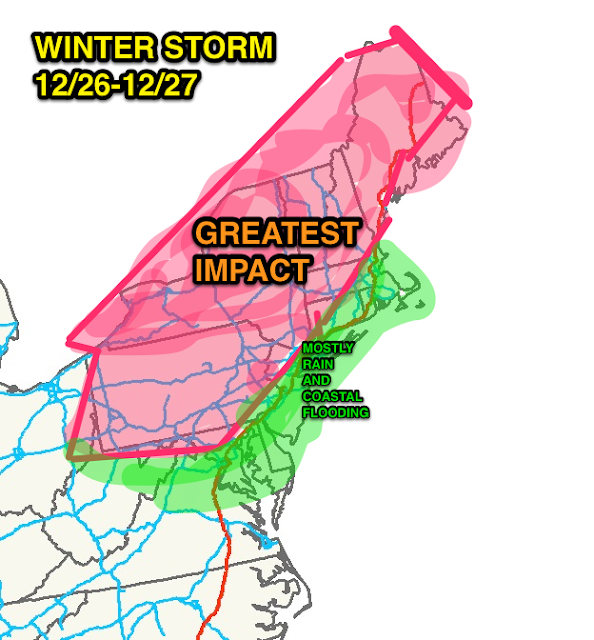
WEDNESDAY AFTERNOON INTO THURSDAY AFTERNOON: Heavy rain/strong winds near the coast, with mixed precip/ice inland. High potential for coastal flooding. Heaviest snows well inland, with upwards of a foot in the pure snow-zone, up to half that amount in the "mix" zones. Coast stays wet, while inland and points north are white. Windy conditions will persist into early Friday morning.
 |
| KG's Opinion |
ACCUWEATHER
Intellicast temps:
SATURDAY INTO EARLY SUNDAY: Potential increasing for another winter storm. Strong shot of cold air arrive for New Years' Eve/Day, with arctic air mass enveloping the region.
 |
| CPC.NOAA.GOV |
 |
| CPC.NOAA.GOV |


No comments:
Post a Comment