I think so
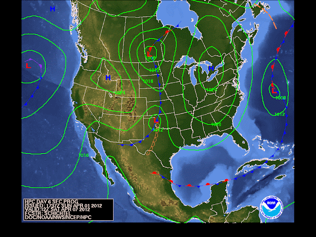
Here's NOAA's long-range weather map for this coming Saturday showing the storm well to our south. This wouldn't even be close if this verifies:
The depiction from NOAA closely resembles the GFS model seen here for the period on Friday, the day before (Good Friday). The upper right hand panel shows the storm off of Charleston, SC:
The boys at Upton are still leaving the door open for the storm for Friday into Saturday. Meanwhile, our neighboring office (and a fine one at that) in the Philly Weather Service is leaving the forecast dry, and they mention that the International model suite has the same solution as the American (GFS) model suite at this time.
All in all, the trend for no storm at all continues, but it still bares watching...
more later...


No comments:
Post a Comment