 |
| NOAA |
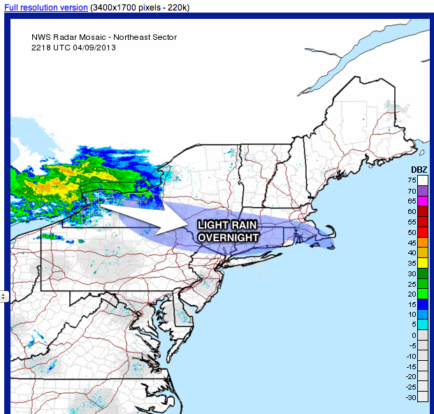
A few showers could sneak in overnight, especially north and west of the city.
The spring/early summer temp spike will finish up tomorrow, with many areas in NYC in the mid-70s yet again.
The front which has caused a lot of forecaster consternation this week will advance in late day tomorrow, sparking some thunderstorms from NYC north and west (including most of New Jersey).
 |
| Accu-weather |
Leftover showers and clouds will eventually spill into the coastal sections at night, with fog developing late tomorrow night into Thursday. Thunderstorms are not as likely near the coast, as the marine influence will tend to weaken anything that comes from the north and west.
Raw, chilly conditions will persist into thursday and Friday. it will be a rude shock with temps struggling to get to 50 on the coast, with only lower to mid 50s in the warmer urban spots.
Rainfall will be rather spotty and drizzly through much of Thursday, but then steady rainfall takes shape for early Friday morning into much of Friday afternoon before ending Friday evening. A good soaking is in store area-wide, with most places easily picking up near an inch of precip by the time it winds down Friday evening.
A dry, pleasant weekend follows, with slowly moderating temps to above-normal through early next week.
 |
| Intellicast |

No comments:
Post a Comment