 |
| NOAA products show about a tenth of an inch of liquid falling tomorrow. |
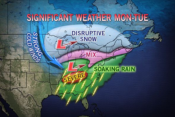
2. Sunday into Monday morning are dry, than a soaking rainfall will encompass the region. Temps quite raw and chilly for this time of year Monday night into Tuesday, which is when the bulk of the rain will fall. Continued highs near 40 at best through the period.
 |
| WPC.gov shows potential for 1-2 inches of rain Monday night/Tuesda |
3. Higher elevations north and west of NYC stand the best shot at mixed precip through the entire storm for Monday night into Tuesday morning.
 |
| Accu-weather |
5. Dry Wednesday-Friday, but temps will struggle to reach the mid-40s through the end of next week. Pattern remains bottled up and blocky, which will mean the persistent pattern of cold and storminess will continue until it breaks down.


No comments:
Post a Comment