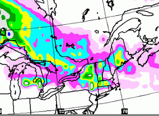
It's not going to be much, but the highest elevations of the Berkshires and Catskills will see some 1-2 inch totals. The accuweather map from the previous post from Wednesday was a bit too far south (in New York State) with its snow axis. They don't even had the story on their site any longer. of course, to be fair, we won't know if this is the case til after the storm on Saturday is by the area.
Here is the GFS model. The green and pink areas are where snow can fly the next two days.
For our immediate neck of the woods, Sunday's still the best weekend day as per the video from Tuesday. However, some light rain will move in Sunday night and continue into Monday before it quits Monday midday.
This was not in the last overview
The upcoming overview will come out tomorrow or Sunday in usual form, followed by a mid week video. It will try to nail down the Easter situation. Right now, it might be much ado about nothing as models are backing off on their more bullish idea of cold and stormy for next weekend.
more later. . .


No comments:
Post a Comment