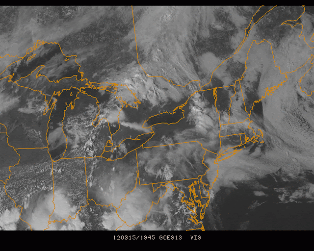
Temps were stuck in the 40s all day, before a late day spike into 50s territory.
The visible satellite picture says it all...
Low clouds and an easterly flow have melted most of the 60 degree temps to Pennsylvania...
After showers tomorrow afternoon and night, the sun returns. But it'll take most of the weekend to get full sun for coastal locations, as the east winds hold on, albeit with no rain after tomorrow.
See previous posts for ideas on temps
After that, another surge of record warmth is likely early next week and beyond, as models will not catch up to the reality of the temps next Tuesday and Wednesday. Highs are already showing near 70 for Tuesday-Thursday on the GFS, and this is probably underdone for most, if not all locations (due to an expected wind from the west, NOT from the ocean like today).
GFS Tuesday from the Penn State EWALL Site. Minimums on the left, max temps on the right:
Wednesday:
Thursday:
We'll watch and see if these temps (while still remarkable in their own right if they verify) are still too low when all is said and done...


No comments:
Post a Comment