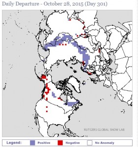
RATIONALE: The backdrop of the upcoming winter season revolves around a strong El Nino, warm sea-surface temperatures near the east coast and in the northern Pacific Ocean, rapid expansion of Siberian snow cover and an active southern jet stream. All of the aformentioned factors will work in concert to produce an abundance of storms this year. The phasing of the northern and southern branches of the jet stream will be critical in pinpointing exactly where the heaviest snows fall during any one particular storm. Look for a lot of variability in forecasts in the run-up to potential threats yet again this season.
 |
| Snow cover as of 10/28/15 |
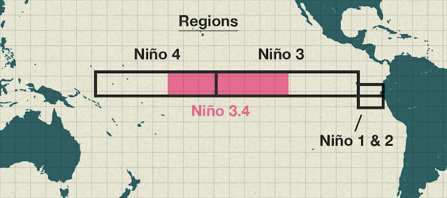
The one critical characteristic of the El Nino this year which gives us a clue to the winter, lies in Region 3.4; in short, warmer water in the Central Pacific as opposed to closer to South America, tends to favor higher snowfall totals over the Southern and Eastern states.
 |
| El Nino Regions |
In El Nino years where the opposite is true (warmer water closer to South America in Regions 1.2 and slightly cooler water in the Central Pacific), our winters tend to be more benign, allowing for more rain chances closer to the coast and longer intrusions of mild, Pacific air.
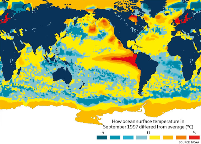
How This El Nino Compares To The "Super-Nino" of 1997.
 |
| Water Temps: October, 2015 |
 |
| Water Temps: September, 1997 |
Generally speaking, winters of this type ebb and flow. There will be periods of warmer weather with less storms, much like we saw from mid-December to mid-January in the last winter.
Typically, in El Nino winters, late January to late March tends to be the worst part. Examples of this would be 2009-10, 2002-03, and 2010-11.
WHAT COULD GO WRONG: Similar El Nino winters have sometimes favored a storm track further to our south. A good example of this can be found in the winter of 1986-1987, which brought record-setting snows to the Mid-Atlantic region while brushing the immediate Tri-State area and points north. Also, as noted above, storms which involve phasing of the two branches of the jet stream could lead to inland storm tracks; an inland storm track would pull in mild air, cutting down on seasonal snowfall accumulations, particularly towards the coast.
CPC: NOAA Winter Outlook
Meteorologist Joe Cioffi's Winter Outlook
Weatherbell Winter Outlook
Steven DeMartino's Winter Outlook
THE BOTTOM LINE: Prepare for another cold, stormy season, with the emphasis on mid-to-late winter. This season should also be slow to relent much like last year.


No comments:
Post a Comment