Sunday, July 12, 2015

A LOOK AT THE WEEK AHEAD

1. After a classic summer weekend of sunshine and temps in the 80s and 90s, we'll see slightly cooler conditions for Monday. Light southeast winds will keep temps in the mid 80s under sunny skies. Clouds come in late in the day and continue to build overhead for Monday night, with an isolated shower in a few places very late Monday night.

2. Tuesday is cloudy and humid. Late day showers and thunderstorms are a good bet Tuesday afternoon and night .  Weak steering flow in the atmosphere will allow storms to dump heavy rain.

3. Position of a weakening cold front will determine Wednesday's overall weather. Low confidence due to the variability of the models; this will have to be addressed in an update, which will come sometime tomorrow night. For now, plan for a good chance of an afternoon or evening shower or thunderstorm.


Weather Nation


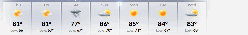
4. Sunshine returns Thursday through Friday, with less humid conditions. Temps will stay in the 80s. More humid Saturday; an isolated shot at scattered storms comes about by Saturday afternoon and night, with the greatest risk for storms during the weekend being Sunday as a cold front enters the region.

Wednesday, July 8, 2015

THREAT OF SHOWERS AND DOWNPOURS WILL CONTINUE THURSDAY AFTERNOON AND NIGHT

The scattered thunderstorms that affect the region tonight will wane overnight. Most of the day on Thursday should be mainly cloudy and muggy, with highs near 80. The cloud cover will preclude the development of thunderstorms during the day; however, showers with drenching downpours are a good bet towards late afternoon and through the evening as an upper air disturbance tracks near or over the area.

Penn State Ewall Maps


After the rainfall for Thursday exits the area, warm, but less humid weather and sunshine will build in for the majority of the weekend.  Chances for the next round of rainfall in the form of showers won't arrive until very late Sunday or early Monday.

7online.com/weather


Early next week looks unsettled and humid once again, as another nearby front stalls and allows small disturbances to move over or close to the region; this will touch off afternoon and evening showers and storms for Monday through Wednesday.

In the long term, prolonged heat stays to our south and a wet pattern may take hold mid-month and beyond.

Thursday, July 2, 2015

YOUR 4TH OF JULY WEEKEND WEATHER HIGHLIGHTS

After a dry day Friday, skies become mostly cloudy for Friday night into much of Saturday. The best chances for a stray shower and thunderstorm appear to be to the north and west of the city and also in an area over extreme southern New Jersey. Most places will remain dry through the weekend, but the better day is Sunday, as full sunshine will work back in. Temps for Independence Day will be in the mid 70s, with readings a few degrees higher on Sunday.

more later....

7pm Saturday: Area is dry, but cloudy

7online.com/weather
Overall water temp profile: Cool North Atlantic, but warm near east coast


Wednesday, June 24, 2015

COOLER AND MORE UNSETTLED WEATHER AS WE CLOSE OUT JUNE

A major change in the weather pattern will pave the way for excessive heat in the west and cool, wet and unsettled conditions in the eastern states; the transition will start Thursday and last through a good portion of next week.

Waves of low pressure will affect the region every couple of days, with bouts of rain and cool temps. The first storm will arrive tomorrow night and last through part of Friday morning before tapering off during the day. We should see around a half an inch of rainfall during this time frame.

On its heels, another area of low pressure will move into the region for Saturday with a more substantial shot at a soaking rainfall on the order of 1-2 inches. The current guidance indicates that rain will arrive around noon and continue through early Sunday morning before quitting by Sunday afternoon. If this materializes, it'll be a rare summer washout, with consistent rainfall over a period of at least 6-12 hours.


Along with this storm and a strong northeast wind flow, temps will be well-below normal levels with readings only topping out near 70F.

Weather Underground for smartphone


Another break in rain returns for Sunday afternoon through Monday. By Tuesday afternoon and night, more rain in the form of showers and thunderstorms creep in and move out by Wednesday morning.

CPC: 6-10 day temp outlook