Sunday, June 15, 2014

HEAT AND STORMS THIS WEEK

1. Temp Rundown: Warmest weather of the late spring season on tap this week. Apex of heat will be Tuesday/Wednesday, with the best shot at seeing 90-degree plus readings on Wednesday in the warmest urban locales (Newark, NYC). Further South near Trenton and Philadelphia and points south, they could hit 90 degrees twice in the Tuesday-Thursday timeframe.
NOAA: Highs Wednesday


2. Rain: Rain chances will begin Monday night, as a weakening area of showers and thunderstorms approaches and moves through at night. On Tuesday night, another shot at storms comes calling, with best chances north and west of NYC. Wednesday afternoon, we may have enough ingredients for a line of pretty potent storms, as a cold front works through for the late week period and knocks our temps down to normal.

Intellicast


3. Late Week/Weekend: Thursday looks like storm chances start to decrease again. The main threat area would be north and west of the NYC metro. Even less chances for storms for Friday. However, with this week's frontal boundary still around, its ultimate placement will determine how dry the weekend will be.

Sunday, June 8, 2014

A HUMID, UNSETTLED WEEK AHEAD, WITH A DRY WEEKEND TO FOLLOW

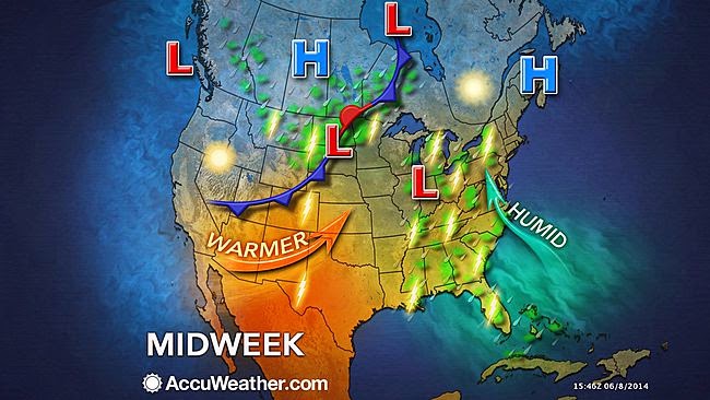
1. Difficult forecast this period as waves of low pressure will trigger scattered showers and some thunderstorms at times this week. Continued heavy rains over the southern plains states will inhibit the development of oppressive summer heat from making it in here through at least mid month.

NOAA 5-day precip totals through 7am Saturday


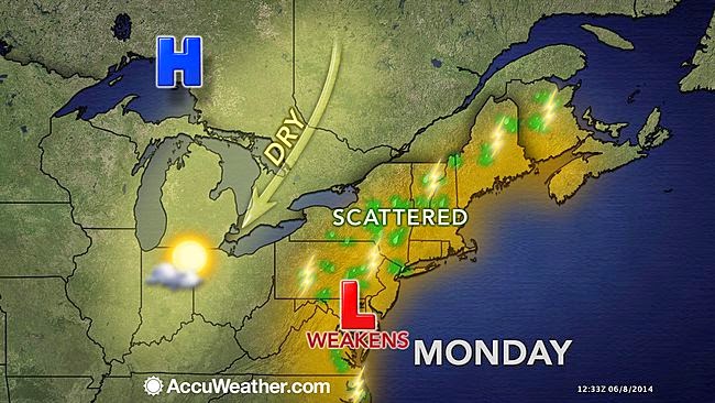
2. MONDAY: Mainly cloudy, with showers in the morning. There will be a break, but more showers are possible late in the day throughout the night Monday night.

Accuweather.com


3. TUESDAY: More of the same, but the best chances for showers will be away from the coast. The likelihood of precip starts to drop off for Tuesday night into Wednesday. Wednesday is the best bet for a dry day during the week.

Accuweather.com

4. Increase in showers and thunderstorms for Thursday afternoon through Friday. Models are in good agreement that the weekend is dry after the cold front passes on Friday.

Intellicast.com


5. Hurricane Season should be a quiet one overall for a second straight year.


Thursday, May 29, 2014

POINTS TO PONDER AS WE WONDER (INTO JUNE)

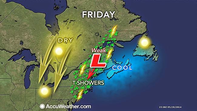
1. Friday: Threat of showers and storms is minimal, but cloud cover will increase. Best chance of quick-hitting rain would be afternoon and evening before things die down.
Accuweather

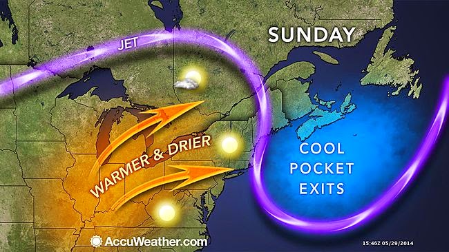
2. Saturday: Best chance of showers should be confined to areas west of NYC as opposed to Friday's chances, where all areas have at least a shot at some rainfall. Otherwise, the weekend should be cloud-free, with generally warming temps beginning Sunday (to above normal for this time of year).

Accuweather


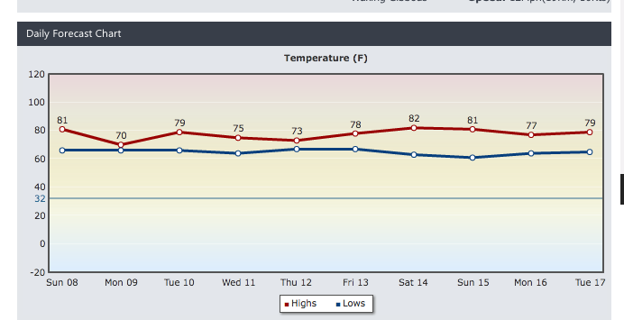
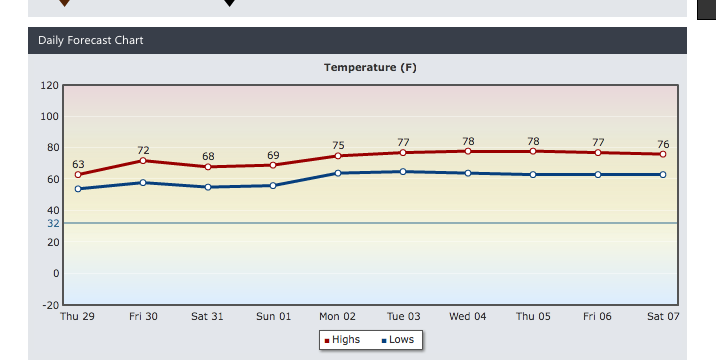
3. Continued warm and dry Monday. Temps will spike to their highest levels of the week for Tuesday into Wednesday, possibly as much as 5-7 degrees higher than what's portrayed below.  However, along with the warmth, we'll see an increase in shower/thunderstorm chances, particularly Tuesday night into Wednesday.


Intellicast.com


Sunday, May 18, 2014

SOMEWHAT UNSETTLED WEATHER FOR MID TO LATE WEEK, BUT A NICE MEMORIAL DAY WEEKEND.

1. Nearby offshore low will spawn scattered showers Monday, particularly over Long Island and eastern Connecticut. Most showers will happen during the afternoon. No rain is expected during the night or in the morning as parameters  of maximum instability aloft and daytime heating are not at their strongest.

Accuweather.com


2. Tuesday is our best day of the work week. Conditions will be dry for all areas as high pressure is able to nudge the stubborn offshore low slightly to the east.

3. Wednesday: Our next front will move through, bringing increasing chances for showers and thunderstorms to the area. Our best shot at widespread showers/storms will come late in the day and at night, before tapering off early Thursday morning.

Accuweather.com


4. After the front crosses, any chances of widely scattered showers Thursday through Saturday will be relegated to afternoon hours, with little to no shower activity during the night and early morning. Again, instability aloft acting in tandem with max daytime heating will contribute to a somewhat unsettled overall pattern late week.

Intellicast.com 


5. Sunday and Monday look like the best days overall of the holiday weekend, but overall the weekend looks very pleasant. Memorial Day may see temps make a run at 80 in NYC, with sunny skies.