Friday, March 1, 2013

MID WEEK STORM RUNDOWN...


The blocking pattern we’re in now is usually a pre-cursor to a major, slow-moving storm along the eastern seaboard.  It should be no surprise to those who read here as to why this could happen; but now the possibility is growing even larger as model guidance is starting to converge on the general theme of the intense storm, with the details of the actual track still to be worked out in full.

TIMEFRAME: Wednesday through a large portion of Thursday
 
STORM SCENARIOS:


In terms of precipitation, prospects for an all-snow event for NYC and the coast are low, but even residents there could still end up with a heavy accumulation at the end of the storm, with at least half of the event being rain. Inland areas stand to get the most snowfall, with the highest (right now) potential for a disruptive snowstorm south and west of Interstate 95.
 
for the coast,  the unfortunate scenario of a siege on the very fragile coastal sections of New Jersey and New York is a very real possibility (even with a more off-shore track), as the painfully slow-moving storm would pile water into our shorelines for 1-2 days! The saving grace is that the astronomical tide cycle is low, which will mitigate (somewhat) the affects of coastal flooding and beach erosion.
 
More later.

Tuesday, February 26, 2013

COOL AND UNSETTLED TO OPEN MARCH

The shot at an early spring is on hold for now as a deep pool of cool air will be anchored over the eastern two thirds of the US for the foreseeable future.

 Along with variable cloud cover and brisk, the weather will have a tendency to be showery during the day, with isolated pockets here and there (Saturday, Monday and Tuesday look driest). Few if any showers will be around at night, with no "trigger" available due the loss of the daytime warming aloft.

Intellicast

Intellicast

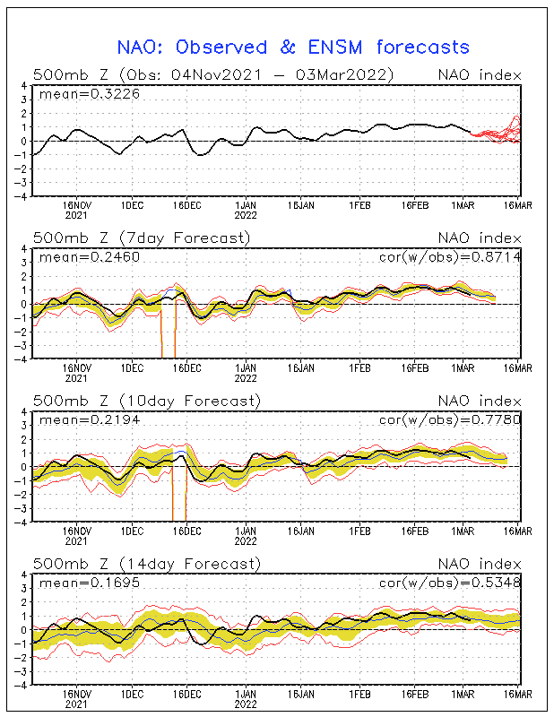
The "blocking" pattern we're in now often leads to the development of major late winter/early spring storms, particularly along the eastern seaboard. Our next real shot at anything significant could come between Tuesday and Wednesday.

Overall, after Wednesday of this week, no widespread, organized precipitation is in the offing.

In a nutshell: Truly Irish weather to open up March.

Perfect timing...

Accuweather

Wednesday, February 20, 2013

IT'S ONE STORM AFTER ANOTHER NEXT 10-15 DAYS

STORM #1: Significant rainfall (up to an inch) with windy conditions likely for NYC and coast Saturday into early Sunday morning, before precip lets up. Mixed precip/snow likely inland north of I-95; best shot at heavy snowfall exists for Orange/Putnam counties and points to the north.


STORM #2: Tuesday and Tuesday night, another significant storm system will move through, bringing a variety of precipitation to the region. Right now, it's a similar evolution to the first storm, with rain at the coast and mix to snow the further north you head.

STORM #3: Very high potential for yet another significant storm for the weekend of 3/1, as pattern of storms "matures." Some similarities are already showing up to past periods where unusually strong coastal storms developed and affected the east coast. Bares close watch (even after this timeframe, as volatile pattern shows longevity through at least March 5-6 before eroding).

TEMPS: Overall, temps look to be near to above normal starting Friday

Intellicast


Friday, February 15, 2013

WINTER WILL FINISH WITH A FROZEN FLOURISH

1. Models still "see" the storm threat, but much less so than before. Trend since tuesday has shown this, with few exceptions (yesterday). Therefore, expect mainly light rain/snow Friday night, then again Saturday night into Sunday. Mainly dry weekend, as ferocious storm JUST misses to our east.

Accu-weather

2. Strengthening off-shore monster will make it blustery and very cold Sunday into Monday. Windy Sunday night. High struggle to the 30-degree mark Sunday, with mid-30s for Presidents' Day. Teens at night Sunday night. 

3. Rain arrives Tuesday afternoon into Tuesday night before clearing. Warmer, with highs in the 40s under cloudy skies. Some snow showers could streak in late Tuesday, but these will be light. 

4. Push of renewed cold takes hold Wednesday and beyond, with an eye towards a developing storm for late next week. Stormy pattern should continue as advertised through the rest of the month. 


accu-weather

Monday, February 11, 2013

ACCUMULATING SNOWFALL LOOKING MORE LIKELY WEDNESDAY NIGHT INTO THURSDAY MORNING


A storm which looked to be a problem for the Middle-Atlantic states is now trending more to the north with the latest model guidance. 

weatherbell Analytics 


This system would present the real possibility of delivering a 3-6 inch type storm, with a fairly high potential for impact on the morning commute for Thursday morning.
Some rain would begin Wednesday early evening, but quickly transition to snow for all areas through the evening and overnight. This looks like a fast-moving, 4-6 hour snowfall.

NOAA

PRELIMINARY SCHOOL CLOSING/SNOW DAY OUTLOOK From the great blog Weather Centre.

NOT LIKELY 

The rest of the overview is on track.
Frequent updates this week will come because of the snow threats (one for Wednesday night and the other for the weekend)
More later.

Sunday, February 10, 2013

ACTIVE, STORMY PATTERN TO CONTINUE THROUGH THE REST OF FEBRUARY

1. Dangerous travel/driving overnight for Long Island and the outer suburbs, as freezing threat looms. NYC and points south and west see mainly light rain/sleet overnight, with some slick spots. Plain rain takes over mid-morning everywhere, ending late in the day. Temps rise into the low 40s. Minor flooding likely from combination of snowmelt and rain.

NOAA

2. Windy day tuesday, but temps remain in the 40s. it will feel cold though, as winds remain fairly high through the day before subsiding at night. 

3. Wednesday night/thursday: some light rain/snow possible, but odds are low as a storm will stay to our south. 

4. Cooler weather settles in for the weekend. Watching for another winter storm late in the weekend, early next week. 


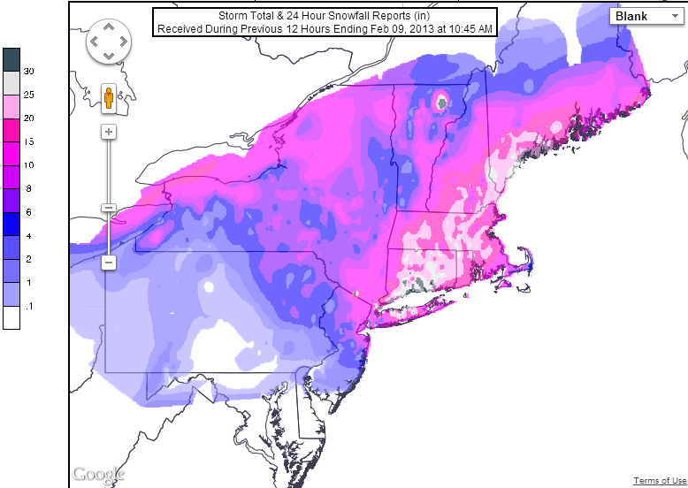
5. Blizzard this past week was historic in some places! Most spots around the city got between 6-12 inches